
Nature of Source
Introduction
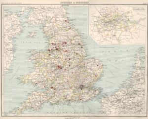
County and local histories provide written political, religious and social histories of counties, arranged by towns and parishes. These works often cover the geographical and topographical evolution of regions. Understanding the historic county boundaries and political geography is crucial for family history research, as administrative structures have changed significantly over the centuries. Understanding these historical and administrative changes helps family historians locate ancestral records accurately.
Historical Context of Counties
The county structure in England was established after the Norman Conquest in 1066, largely based on former Anglo-Saxon shires. Traditionally, a shire referred to an administrative division of land surrounding a fortified town or castle. A sheriff administered the area and was responsible for tax collection, law enforcement and raising men to fight for the King. The county structure (derived from the French ‘counté’) gradually replaced the ‘shire’ although many retained ‘shire’ in their names. Counties were initially controlled by Earls (or Counts) on behalf of the monarch. The most significant settlement within a county became the county town, known as a burgh in Scotland and a borough in England. The post of sheriff remains in place in Scotland.
Local Government Reforms
Several key legislative acts shaped county administration.
Local Government Act (1888)
The Act established county councils and county boroughs in England and Wales. The newly formed administrations assumed the powers and responsibilities of various local bodies and carried out much of the work previously administered by the Quarter Session courts. Duties included the management of the county police and overseeing services like roads, education and health. Voters elected representatives to serve on the council.
Local Government Act (1888) London Reforms
The Local Government Act of 1888 created two new local government entities
London County Council
The Local Government Act of 1888 also established the London County Council (LCC), taking over from its predecessor, the Metropolitan Board of Works which had been appointed rather than elected. The first elections for the LCC were held in January 1889 and the council formally began work on 21 March 1889. The LCC was the governing body of the County of London and was London’s first elected strategic body. The Council included constituencies covering the same areas as those for parliamentary elections as well as 28 metropolitan boroughs which replaced the civil parishes. The LCC remained the local authority for London until its abolition on 1 April 1965 when it was succeeded by the Greater London Council.
County of London
The County of London was officially established on 1 April 1889 by the Local Government Act 1888. The County consisted of the area covered by the Metropolitan Board of Works which was established in 1856. The new London-wide county covered parts of the metropolitan or ‘central’ areas of the ancient counties of Surrey (including Lambeth, Southwark, Newington and Wandsworth), Middlesex, Kent and the City of London, which remained under separate jurisdiction. The remaining areas of Middlesex survived as a small county council until 1965. The County added the 28 metropolitan boroughs which were established in 1900 by the Local Government Act, replacing the previous system of vestries and district boards.
1894 Local Government Act
The Act introduced a second tier of local government below county councils by establishing Urban and Rural District Councils with elected councillors, replacing the Urban and Rural Sanitary Authorities. The Act also introduced elected Parish Councils for rural areas, assuming powers previously held by parish vestries. The new council’s duties related to public health, sewerage, street cleaning and local planning.
London Government Act (1963)
The London Government Act 1972, which came into effect on 1 April 1965, abolished the administrative counties of London and Middlesex as well as the 28 metropolitan boroughs created in 1900. The Act formed Greater London taking in further areas of Kent and Surrey as well as parts of Essex and Hertfordshire and created an administrative area comprising 32 London boroughs, 12 inner and 20 outer boroughs. In addition, the London County Council was replaced by the Greater London Council (GLC) with a remit to govern the entire Greater London area. The Greater London Council was abolished on 1 April 1986 as a result of the Local Government Act of 1985. The Greater London Authority (GLA) was officially established on July 3, 2000 and London once again gained an elected strategic body with the establishment of the Greater London Assembly as well as an elected Mayor of London. The GENUKI webpage provides key information about London’s administrative units and changes and a listing of the present-day boroughs of Greater London, their original counties and the Metropolitan Boroughs they replaced.
1974 Local Government Act
The Local Government Act 1972, which came into effect on 1 April 1974, fundamentally reorganised and restructured local government in England and Wales. The Act created entirely new counties responsible for larger geographical areas and smaller district councils within those counties which replaced former urban and rural districts. The Act introduced Metropolitan counties in urban areas including Greater Manchester, Merseyside, South Yorkshire, Tyne & Wear, West Midlands, and West Yorkshire. The Act also saw the demise of some historic counties such as Cumberland and Westmorland, replaced by a single county of Cumbria. It is important to note that the Act only affected administrative counties and not the ancient historic counties.
Where to Find County Records
Understanding where to find county records is essential for family history research and tracing ancestors. It is also important to know the ancient county where an ancestor lived. A current administrative unit may not align precisely with the geographical boundaries of an older county, which means records could be distributed across various record offices. In England before the 1974 reforms, local government consisted of county councils and below them a mixture of city, burgh or borough, metropolitan district, urban district and rural district councils.
For those with London ancestors, records are distributed amongst the following archive centres:
- The London Archives: Holds records for the County of London (which will include the present London Boroughs of Lambeth, Southwark including Newington and Wandsworth), Middlesex and the City of London.
- Surrey History Centre (Woking): Houses historical records from the Diocese of Southwark (excluding South London and Sutton).
- Lambeth Archives: Holds the pre-1889 Surrey records.
- East Surrey Family History Society: Holds records covering the London Boroughs of Croydon, Kingston, Lambeth, Merton, Richmond, Southwark, Sutton and Wandsworth.
- City of Westminster Archives Centre: Manages records from the City of Westminster (granted city status in 1900), including former metropolitan boroughs of St Marylebone and Paddington.
County histories often contain records dating back to medieval times, including manorial documents, property records and early taxation lists as well as other later local governance records such as tax rolls, property deeds and voting registers. Search the Society of Genealogist’s Library Catalogue for their research records covering counties across the county and visit GENUKI for information on individual counties as well as contact details of record offices, local studies libraries and family history centres. Details of County Record Offices and local archives can also be found at The National Archives Find and Archive directory. The Federation of Family History Societies has a dedicated section for locating societies across the UK and beyond.
The Victoria County History series offers an invaluable resource for researching county records from medieval times to modern day. The project is dedicated to researching and writing the history of every county in England, providing a detailed account of the local, social, family and economic history of a county.
Key Responsibilities
County councils in England have been responsible for a wide range of services since their establishment in 1889. Their powers and responsibilities have evolved over time and have at various points been responsible for:
- Education including elementary and secondary schooling.
- Highways and transportation.
- Planning.
- Public health including managing local hospitals and healthcare facilities.
- Social services.
In 1929, council powers expanded to include:
- Poor relief (previously handled by Poor Law Unions) and other welfare services for those in need.
- Transfer of Poor Law hospitals (workhouse infirmaries) to local authority administration.
- Education (taking over from school boards)
Records of the official minutes detailing the decisions of the local authority and work carried out by the various departments are available at County Record Offices. The records could show the names, occupations, addresses of those employed by the Local Authority.
Scotland
The Local Government (Scotland) Act 1889 established 33 counties which were responsible for a wide range of services and contained various types of burghs. In 1975, a major reorganisation took place following the Local Government (Scotland) Act of 1973. The Act introduced a two-tier system consisting of nine regions, 53 districts, and three island areas. The new structure abolished the previous system of counties, burghs and landward districts (parts of counties that were not classified as burghs). In 1996, following the Local Government (Scotland) Act 1994, Scotland moved to a system of 32 unitary authorities which abolished the regions and districts created in 1975. It is important to note that while the county structure has changed, many family historians still refer to county archives.
Historically, burghs played a significant role in Scottish local government. The burgh was the most significant settlement within a county typically becoming the county town. It held special legal status enjoying certain privileges such as raising taxes and levying tolls. Royal burghs, created by royal charter, held additional privileges in foreign trade and representation in parliament.
In Scotland, most records are centralised and can be accessed online through Scotland’s People or at the National Records of Scotland. The Scottish Association of Family History Societies is a valuable resource for research and acts as an umbrella organisation for a wide range of local and regional family history societies throughout the world. County record offices and libraries are listed in The National Archives Find an archive facility and Find a local library section at mygov.scot.
Wales
The structure of Welsh counties was laid in 1536 with the Act of Union between England and Wales, forming 13 historic counties that remained largely unchanged for centuries. The Local Government Act of 1889 created administrative counties based on these historic counties with some modifications. The structure remained in place until the major reforms in 1974 which replaced the existing counties with eight new two-tier counties divided into 37 districts. In 1996, further reforms resulted the creation of 22 unitary authorities, replacing the eight counties and their districts.
It is important to note that the historic counties of Wales were never legally abolished and continue to exist for certain ceremonial purposes.
Northern Ireland/Ireland
Ireland is traditionally divided into four provinces: Ulster, Munster, Leinster and Connacht. Northern Ireland forms part of the historic Province of Ulster which originally comprised of nine counties. Today, Ulster is divided between the Republic of Ireland and Northern Ireland. After the Irish War of Independence (1919-1921), six of these counties (Antrim, Armagh, Down, Fermanagh, Londonderry and Tyrone) remained within the United Kingdom, forming Northern Ireland. The remaining three Ulster counties (Cavan, Donegal, and Monaghan) became part of the newly formed Irish Free State (later the Republic of Ireland). Generally ‘Ulster’ refers to the six counties but Ulster continues to exist as a cultural and historic entity.
The Local Government (Ireland) Act 1898 created a similar county-based structure similar to that in England and Wales. However counties evolved much earlier following the Norman Conquest sub-divided into baronies, parishes and the smallest unit the townland.
In 1973, Northern Ireland underwent a significant reorganization of its local government structure. The six counties and other administrative units were replaced by 26 single-tier District Councils. This reform came into effect on 1 October 1 1973, replacing the previous system of county councils, county borough and municipal borough corporations and urban and rural district councils. In 1922, 26 Irish counties seceded from British control, establishing the Irish Free State on December 6, 1922. The fully independent Republic of Ireland as we know it today was not established until 1949.
The Irish Family History Foundation coordinates a network of county genealogy centres and family history societies on the island of Ireland, providing a unique resource for family historians. The centres throughout Ireland, offer services such as record searches and commissioned research. For those researching specifically in Northern Ireland, the Public Record Office of Northern Ireland provides guidance and access to various historical records and documents relevant to Northern Irish family history.
Understanding the UK and the British Isles
- The United Kingdom (UK) is made up of Great Britain plus Northern Ireland
- Great Britain consists of England, Wales, and Scotland
- The British Isles is a geographical term with no legal standing incorporating:
- Great Britain (England, Wales, and Scotland)
- Ireland (Northern Ireland and the Republic of Ireland)
- Numerous smaller islands and island groups
- The Channel Islands and the Isle of Man are Crown Dependencies and sometimes included in the British Isles grouping
United Kingdom: Countries and Governance
The United Kingdom is a unitary sovereign state composed of four countries: England, Scotland, Wales, and Northern Ireland each with varying degrees of autonomy. Scotland is a separate country within the United Kingdom but not a fully independent nation. The crowns of England and Scotland united in 1603 when James VI of Scotland became James I of England. The political union of England and Scotland occurred on 1 May 1 1707, with the Acts of Union which created the Kingdom of Great Britain. The Laws in Wales Acts of 1535 and 1542 incorporated Wales into the Kingdom of England. Wales has its own devolved government and is recognised as a country within the United Kingdom. The title ‘Prince of Wales’ is held by the heir apparent to the British throne and is purely a ceremonial title.
Ireland: A Divided Island
The island of Ireland is a geographical landmass that includes Northern Ireland and Éire (Republic of Ireland). Northern Ireland is a largely self-governing part of the United Kingdom through a devolved government set in place following the Good Friday Agreement in 1998. The Irish Free State was established on 6 December 1922 following the Anglo-Irish Treaty of 1921. The Constitution of Ireland of 1937 declared the name of the state to be Éire (Ireland) and the fully independent Republic of Ireland was established in 1949 but retained the constitutional name of Éire.
Also see
Directories, Trade, Professional, Telephone & Street
Maps & Gazetteers
Photographs, Prints & Postcards
Statistical Accounts of Scotland
Where Found
County Record Offices
County Record Offices hold a number of records useful for local and county research including:
- Council records including minutes and reports from local councils detailing council policies and decisions
- Departmental work records
- Employment records
- Education and Public Health records
- Borough records from ancient boroughs within the county
- Local trade directories such as Kelly’s listing businesses and residents
- Business records
- Local newspapers
- Historic maps
- Photographs and illustrations
- Victoria County Histories
- County and town histories
Historic England Archive
The Historic England Archive contains over 12 million photographs, drawings, reports, and publications from the 1850s to the present day, covering the archaeology, historic buildings, and social history of England. Over a million of these records are searchable online. You can use the archive to research your home’s history, learn about your local area, research buildings and archaeological sites and discover England’s changing landscapes.
Local Libraries
Libraries offer a wide range of information for researching local history such as books and pamphlets about local towns and villages, often written by local historians, trade directories and local newspapers and photographs.
Local History Societies
Local history societies are dedicated to preserving and promoting the history of a specific village or town. Many societies publish journals, books and newsletters, providing detailed information about local history. Societies often facilitate research and projects into the history of their areas which could include list individual names for family history research.
British Association for Local History
The Association is a national charity dedicated to promoting and supporting local history in the UK. BALH aims to encourage interest and enthusiasm for local history among people of all ages and aims to share and promote best practice, knowledge and skills in the field. BALH publishes various handbooks and pamphlets on local history topics offering background knowledge, practical advice and guidance on sources and methods for local history research. The Association publishes The Local Historian four times a year in conjunction with Local History News. The site hosts a directory of local history societies grouped by county.
Period Covered
1600 – Onwards
Genealogical Value
- Names and family relationships
- Birth, marriage and death dates.
- Addresses and occupations.
- Description and topography of areas and places.
Further References
- Barratt, Nick. Nick Barratt’s Beginner’s Guide to Your Ancestors Lives: Pen and Sword Books, 2010
- Bellerby, Rachel. Tracing Your Yorkshire Ancestors: A Guide for Family Historians: Pen & Sword Books, 2014
- Bellerby, Rachel. Tracing Your Leeds Ancestors: A Guide for Family Historians: Pen and Sword Books, 2015
- Blanchard, Gill. Tracing Your East Anglian Ancestors: Pen and Sword Books, 2009
- Blatchford, Robert. The Family and Local History Handbook: Robert Blatchford Publishing, annual
- Blatchford, Robert & Blatchford, Elizabeth. The Irish Family and Local History Handbook: Robert Blatchford Publishing, annual
- Bristow, Joy. The Local Historian’s Glossary of Words and Terms: Countryside Books, 2001
- Brooks, Pamela. How to Research Local History: How to Books, 2008
- Carter, Paul & Thompson, Kathryn. Sources for Local Historians: Phillimore, 2005
- Cox, Jane. Tracing Your East End Ancestors: A Guide for Family Historians: Pen and Sword Books, 2011
- Currie, C.R.J. & Lewis, C.P. (eds) Guide to English County Histories: Sutton, 1994
- Few, Janet. Putting Your Ancestors in their Place: A Guide to One Place Studies: The Family History Partnership, 2014
- Fillmore, Jacquelené. Local History Internet Sites: British Association for Local History, 2010
- Foster, Janet and Sheppard, Julia. Eds. British Archives: A Guide to Archive Resources in the United Kingdom. 4 ed: Palgrave Macmillan, 2000
- Fowler, Simon. Starting Out in Local History: Countryside Books, 2001
- Friar, Stephen. The Sutton Companion to Local History: Sutton, 2004
- Gibson, Jeremy. Unpublished Personal Name Indexes in Record Offices and Libraries: FFHS, 1985
- Gibson, Jeremy, and Pamela Peskett. Record Offices: How To Find Them, 8th ed: FFHS, 1998
- Gray, Kirsty. Tracing Your West Country Ancestors: Pen & Sword, 2013
- Hawgood, David. One-Place Genealogy: D. Hawgood, 2001
- Hey, David. The Oxford Companion to Family and Local History: OUP, 2008
- Honoré, Sue & Merry, Richard & Feinstein, Jessica. Exploring Oxfordshire Surnames: People, Places and Lives: Matador, 2022
- Jack, Elizabeth. Discover Gloucestershire Ancestors: Your Guide to the Archives Volume 1: Hidden Heritage, 2012
- Jack, Elizabeth. Discover Gloucestershire Ancestors: Your Guide to the Archives Volume 2: Hidden Heritage, 2013
- Line, Paul. A History in Maps, Birmingham: The History Press, 2009
- Meighan, Michael. Glasgow A History: Amberley Publishing, 2013
- Moss, John. A History of English Place Names and Where They Came From: Pen and Sword Books, 2020
- Oates, Dr Jonathan. Tracing Your Ancestors Through Local History Records: A Guide for Family Historians: Pen and Sword Books, 2016
- O’Neill, Robert K. Irish Libraries: Archives, Museums & Genealogical Centres: A Visitor’s Guide: Ulster Historical Foundation, 2010
- O’Shea, Chloe. Tracing your Staffordshire Ancestors: A Guide for Family Historians: Pen and Sword Books, 2025
- Owen, Hywel Wyn. The Place Names of Wales: University of Wales Press, 2005
- Pettyfer, Sarah. Tracing your Surrey Ancestors: A Guide for Family Historians: Pen and Sword Books, 2025
- Pryor, Francis. The Making of the British Landscape : How we have Transformed the Land from Prehistory to Today: Penguin, 2011
- Raymond, Stuart. Tracing Your Ancestors in County Records: A Guide for Family and Local Historians: Pen and Sword Books, 2016
- Raymond, Stuart. Researching Local History: Your Guide to the Sources: Pen and Sword Books, 2022
- Reader’s Digest. Local History Detective: Reader’s Digest, 2007
- Redmonds, George. Names and History: People, Places and Things: Hambledon, 2004
- Richardson, John. The Local Historians Encyclopedia: Historical Publications, 2003
- Royden, Mike. Tracing Your Liverpool Ancestors: A Guide For Family Historians: Pen and Sword Books, 2014
- Sharpe, Michael. Tracing Your Birmingham Ancestors: A Guide for Family and Local Historians: Pen and Sword Books, 2015
- Showell’s Dictionary of Birmingham: A History and Guide Arranged Alphabetically: (Available to read online or download at Project Gutenberg)
- Stewart, Alan. Tracing Your Edinburgh Ancestors: A Guide for Family and Local Historians: Pen & Sword Books, 2015
- Travers, Tony. London’s Boroughs at 50: Biteback Publishing, 2015
- West, John. Town Records: Phillimore, 1983
- West, John. Village Records: Phillimore, 1997
- Winchester, Angus. Discovering Parish Boundaries: Shire Publications, 2000
- Yorke, Trevor. Tracing the History of Villages: Countryside Books, 2001
- Yorke, Trevor. The English Village Explained England’s Living History: Countryside Books, 2011
- Youngs, F. A. Guide to the Local Administrative Units of England: Royal Historical Society Guides and Handbooks: Cambridge University Press, 1995
London
- Bullman, Joseph & Hegarty, Neil & Hill, Brian. The Secret History of Our Streets: London: BBC Books, 2012
- Dale, T Cyril. The Inhabitants of London in 1638: Society of Genealogists, 1931 (Householders listed by parish showing rents and tithes. Transcribed and available online at British History Online)
- Dale, T Cyril. The Inhabitants of Westminster: 1935 (Extracted from lay subsidy rolls 1625-1645 and available at the Society of Genealogists library. Includes the poll tax of 1641)
- Grynberg, Warren. Images of the City of London: Breedon Publishing, 2009
- Harben, Henry. A Dictionary of London: H Jenkins, 1918. Historical notes of streets and buildings in the City of London, including references to other relevant sources. (Transcribed and available to view at British History Online)
- Honore, Sue, & Merry, Richard & Feinstein, Jessica. Exploring Oxfordshire Surnames: People, Places and Lives: Troubador Publishing, 2022
- Hyde, Ralph. A-Z of Victorian London: London Topographical Society, 1987
- Lockie, John. Lockie’s Topography of London: London, 1810 (Available to download or read online at the Internet Archive)
- London County Council. Names of Streets and Places in the Administrative County of London: Including the Names of Blocks of Dwellings, Parks, and Open Spaces: London County Council, various editions (1901 digital edition available to read online or download at the Internet Archive)
- Marcan, Peter. Greater London History and Heritage Handbook. 4th ed: Peter Marcan Publications, 2008
- Mills, Anthony. A Dictionary of London Place Names: Oxford University Press, 2010
- O’Shea, Chloe. Discover Your Dorset Ancestors: The Family History Partnership, 2022
- Oates, Jonathan. Tracing Your London Ancestors: A Guide for Family Historians: Pen and Sword Books, 2011
- Sharpe, Michael. Tracing Your Birmingham Ancestors: A Guide for Family and Local Historians: Pen and Sword Books, 2015
- Tallis, John. London Street Views 1838-1840: Topographical Society, 1921 (Available to download or read online at the HathiTrust Digital Library)
- Thornbury, Walter & Walford, Edward. Old And New London: A Narrative of its History, its People and its Places: Cassell, 1878 (Available to read and search in digital format at British History Online)
- Tiller, Kate. English Local History: An Introduction: Boydell and Brewer, 2020
- Webb, Cliff. My Ancestors Were Londoners: Society of Genealogists, 2010
Scotland
- Nicolaisen, W.F.H. Scottish Place-Names: John Donald, 2011
- Sinclair, Cecil. Tracing Scottish Local History: Stationery Office, 1996
- Scott, Maggie. Scottish Place Names: Black & White Publishing, 2008
- Taylor, Iain. Place-Names of Scotland: Birlinn, 2011
- Whetstone, Ann. Scottish County Government in the Eighteenth and Nineteenth Centuries: John Donald, 1981
- Wright, David. Tracing Your Kent Ancestors: A Guide for Family and Local Historians: Pen and Sword Books, 2016
Websites
England and Wales
GENUKI
The GENUKI page for England provides comprehensive county specific resources as well as other family history guides categorised into various sections. Each region or county listed within GENUKI provides extensive information related to the local history and family history, maps and various resources specific to that area. The GENUKI Search Page searches the contents of GENUKI for place names and transcribed individual names. The GENUKI Gazetteer covers the whole of England, Ireland, Wales, Scotland, Isle of Man, and the Channel Islands. Use the gazetteer to find the location of places, view online maps, and discover which GENUKI pages may contain information about that place and the genealogical resources which are available for it.
The National Archives Research Guide
How to look for records of Towns and Cities. This is a brief guide to researching records of towns and cities. This guide will help you to identify the key sources of information that will help you with your research.
The National Archives Research Guide
How to research the history of a place: where to start.
Victoria County History
The series offers an invaluable resource for researching county records from medieval times to modern day. The project is dedicated to researching and writing the history of every county in England, providing a detailed account of the local, social, family and economic history of a county.
British History Online
The site offers a digital library containing a large collection of historical materials related to British and Irish history including published histories of London and elsewhere. The site includes both primary and secondary sources, providing access to a wide range of historic government and civic records such as Victoria County Histories, Calendars of State Papers, Close Rolls, Patent Rolls and Hearth Tax Returns. In addition the site hosts 10,000 historical map tiles of the British Isles.
British History Online
Subject guide: Local history on British History Online. The guide covers topics from the history of individual houses and families to entire regions. It explains what local history is and highlights the kinds of resources available on BHO such as primary and secondary sources, maps and calendars.
A Vision of Britain Through Time
The site offers a geographical and social history of Great Britain from 1801 onwards. It site brings together historical surveys of Britain to create a record of how the country and its localities have changed. The site features historical maps, statistical trends and detailed descriptions of places across Britain.
Historic England
Local Heritage Hub. Unlock and explore hidden histories for every county, district, city and major town across England. Each location has its own webpage featuring hidden histories, detailed information about its historic sites and aerial photographs.
Association of British Counties
The society is dedicated to promoting awareness of the continuing importance of the 92 historic or traditional counties of the United Kingdom. The site includes a comprehensive map of the counties, informative profiles of each county and a gazetteer of British place names.
The Historic County Borders Project
The project offers digitised borders of the historic counties of the UK, available for public and commercial use. The site includes a large-scale map of the historic counties of the United Kingdom and profiles of each county.
The Historic Counties Trust
The Trust aims to promote public awareness of the history, geography, natural history, architecture and traditions of the historic counties of the UK. The site includes a large-scale Map of the Historic Counties, a description of each of the historic counties and Historic County Statistics.
Family History Federation
The Federation serves as an umbrella organisation for over 160 family history societies and similar organisations worldwide. It coordinates and assist the work of societies focussing on family history, genealogy and heraldry and promotes cooperation among its members through various projects and initiatives. The Federation is involved in several projects, such as the National Burial Index and publishes family history books.
Office for National Statistics
Administrative geographies. The hierarchy of areas relating to national and local government in the UK. The site provides detailed information on the administrative structure within England, Scotland, Wales and Northern Ireland.
maps.thehunthouse
Notes on the Administration of England And Wales. These notes are taken from the January 1929 edition of Philips’ Handy Administrative Atlas of England and Wales. They give, as concisely as possible, the history and current state of the governance and administration of England and Wales
Society for One-Place Studies
The aims of the Society are to encourage and assist those involved in one-place studies and to advance the education of the general public in these types of studies. An investigation uses various historical records and resources to help researchers understand the social, cultural and economic contexts of a specific area.
FamilySearch Research Wiki
Genealogy guide for England. The site provides an extensive list of historic English counties. with links to a dedicated wiki article with more specific information showing civil registration districts, historic parishes, probate records and jurisdictions, place-names and jurisdictions for each parish.
University of Cambridge
Populations Past. Atlas of Victorian and Edwardian Population. The website allows users to create and view maps of different demographic measures and related socio-economic indicators every 10 years between 1851 and 1911. These include fertility, childhood mortality, marriage, migration status, household compositions, age-structure, occupational status and population density.
Lifelines Research
Our Ancestral Places. The site provides guidance on exploring the lives of ancestors through specific buildings like homes, schools, workplaces and churches to broader areas such as parishes, towns and counties.
Family Tree
The Genealogist’s Guide to Local Histories, By Rick Crume.
Explore Genealogy
Utilising Local History To Research Your Family Tree, by Chris Nickson.
Connected Histories
Local history: a research guide.
Local History Magazine
Getting started in local history.
CuriousFox
Village by village contact site for anyone researching family history, genealogy and local history in the UK and Ireland. Search surnames in any city, village, or town and find place names including many obscure and forgotten villages and hamlets.
UKGDL
The site provides links to websites county by county that offer online data to help you discover what your families did and how they lived. This includes information sources like school lists, trade directories, electoral rolls, passenger lists and old photographs.
The Institute for Name-Studies
The Institute is the home of research into place‑names and personal names at the University of Nottingham. The Institute is home to The English Place-Name Society. The society was established in 1923 to conduct a county-by-county survey of the place-names of England. Almost all English counties have been surveyed at least in part and work to complete the Survey is ongoing.
University of Nottingham
Genealogical and Local History. The University holds a wide variety of material relating to local history. The most comprehensive collection of local material is the East Midlands Collection including resources such as a series of marriage bonds from the historic Archdeaconry of Nottingham and the Family and Estate Collections featuring materials from prominent Nottinghamshire landowning families.
Local History Online
The website is a resource for people interested in local history. The website serves as a hub for a variety of materials including books, news, resources and courses relevant to local historical studies. The Directory of local history and allied societies gives details and links to the websites of 654 local history and related societies.
Mapping the History of Liverpool
The website offers a variety of resources for exploring the history of Liverpool, including old maps of Liverpool, historic townships histories, old streets, parishes as they were in 1851 and all the listed and protected sites on Merseyside.
Cornish Memory
The website features nearly 36,000 historic photos, films and audio recordings covering the whole of Cornwall and Cornish connections abroad, contributed by museums, libraries, archives, and private collectors.
Wishful Thinking
Local History Pages. The website is dedicated to family and local history research covering a number of counties in England and Wales. Most of the information is organised by county-by-county and includes transcriptions of 19th century Directories, Census, and Memorial Inscriptions, Photographs, Articles and Book Reviews. For Gloucestershire research the Ancient Parish Boundary Map is included and the article Gloucestershire Parish Boundary Changes, 1844-1974, by Rosemary Lockie.
West Midlands History
The website which provides free access to a variety of programmes and different media focussing on the history of the people of the West Midlands, their ideas, innovation and industry covering the counties of Herefordshire, Shropshire, Staffordshire, Derbyshire, Warwickshire and Worcestershire.
The Weald
Kent, Surrey and Sussex. This site catalogues the people, places, maps, drawings, engravings, books, writings and numerous lists and directories that are over 70 years old into an integrated database of information about one of the most attractive parts of England.
Archives Wales
The website provides an interactive map and information about various Welsh archive repositories across Wales.
FreeReg
Chapman Codes The codes are a set of three-letter codes used in genealogy to identify the administrative divisions in the British Isles: the United Kingdom (of Great Britain and Northern Ireland), Ireland, the Isle of Man and the Channel Islands. The codes were devised by the historian Dr Colin R Chapman, in the late 1970s. Today, they are a widely used shorthand in genealogy.
Maps
FamilySearch Historical Maps
Interactive mapping tools showing the administrative areas and units of England. For each place name the parish is shown and gives start date for parish registers and Bishop Transcripts. The name of the appropriate Probate Court, Diocese, Province, Poor Law Union and Hundred is shown. Contiguous parishes and parishes within a specified radius can be displayed. In addition map layers can be displayed showing boundaries for the Civil Registration District, the Parish, the County, the Diocese and other administrative areas.
Association of British Counties
Map of the Counties of the United Kingdom.
The Historic Counties Trust
Map of the Historic Counties. This is a large-scale map of the historic counties of the United Kingdom. This map is based on Definition A of the Historic Counties Standard whereby detached parts of counties are associated with their host county. It uses county border data from the Historic County Borders Project. A printable A3-size map is also available.
Office for National Statistics
Administrative Geography Hierarchy Boundaries, December 2022, UK. Administrative geographical areas such as Local Authority Districts, Counties and Unitary Authorities can be selected via the tick boxes alongside each layer.
Ordnance Survey
National, County & Unitary Authority Boundaries: Administrative Boundaries of Great Britain before 1995-1996 unitary changes.
Ordnance Survey
Election maps. A variety of administrative and electoral boundaries that can be overlaid on the mapping including counties, districts, unitary authorities and London boroughs.
GENUKI
Counties of England, Wales and Scotland prior to the 1974 Boundary Changes
Jonathan Rawle
Map of pre-1974 counties of Great Britain.
London
Gendocs
Victorian London A-Z Street Index from Gendocs, archived copy
British History Online
The site offers a digital library containing a large collection of historical materials related to British and Irish history including published histories of London and elsewhere. The site includes both primary and secondary sources, providing access to a wide range of historic government and civic records such as Victoria County Histories, Calendars of State Papers, Close Rolls, Patent Rolls and Hearth Tax Returns. In addition the site hosts 10,000 historical map tiles of the British Isles.
London Lives Historical Background
Local Government. The website highlights the complex administrative patchwork of London, focussing on Westminster, Southwark, City of London and Middlesex.
The Digital Panopticon
The site explores the history of London and its criminal justice system from 1780 to 1900. This page gives a brief introduction to London in this period of dramatic change with reference to subjects such as Population, The Built Environment and Governance and Politics.
Urbanest
London Boroughs: Etymology Explained. Discover the rich history and politics of London’s boroughs. This blog delves into the fascinating stories behind their names.
Know Your London
London Metropolitan Boroughs. The article discusses the history of London’s administrative divisions, focusing on the creation and structure of the Metropolitan Boroughs.
London Hut
The 32 Boroughs and the City of London. Overview of London Boroughs and the City of London.
The Victorian Dictionary
The site offers a compilation of primary sources charting and exploring the social history of nineteenth century London. Created and edited by Lee Jackson.
Survey of London
Histories of Whitechapel. The site allows users to share and explore the many histories of Whitechapel’s buildings and places. The map displays information about every building in Whitechapel with a linked history if available and the facility to overlay modern buildings onto maps including Ordnance Survey 1873 and Rocque 1746.
Bishopsgate Institute
London History. The Institute’s London Collections contains around 150,000 books and pamphlets on the social and cultural history of London, along with 2,000 maps and around 500,000 photographs. The Collection is particularly strong on the Bishopsgate and Spitalfields area.
Scotland
Scottish Records Association
The SRA was founded in 1977 and is concerned with the preservation and use of historical records in Scotland. It provides a forum for users, owners and custodians of records to discuss matters relating to the records, their custody and conservation and research.
GENUKI
Administrative Areas of Scotland. Listing of Scottish historic counties and the successor regions for each.
National Library of Scotland
Scottish Counties and Parishes: their history and boundaries on maps. This guide provides information on local government units in Scotland, particularly parishes and counties, focusing on their boundaries and changes over time.
National Library of Scotland
County maps, 1580s-1950s. Discover maps of the whole county or region, providing an overview of the physical and human landscape. The principal content relates to counties in Scotland, with a small coverage of counties in northern England.
ScotlandsPlaces Gazetteer
The gazetteer is an A-Z index of inhabited places in Scotland, both past and present showing Scottish places and administrative units. The gazetteer is compiled from central and local government records as well as older gazetteers.
ScotlandsPlaces
What’s the difference between counties, parishes, burghs, regions and districts? This is a guide to Scotland’s administrative units, both historically and currently, highlighting how Scotland was divided into counties, parishes and burghs and and later into Regions and Districts.
ScotlandsPeople Guide
Counties, cities and burghs. This guide provides background information on the administrative divisions within Scotland, specifically focusing on counties, cities, and burghs. It explains their historical context, administrative functions and types of family history records available for particular areas of the country.
ScotlandsPeople Guide
Searching by place. Many ScotlandsPeople records can be searched by place, either by using drop-down lists of parishes, districts, burghs or courts, or via a free-text search facility. This guide tells you how to navigate different record sets using these search functions.
ScotlandsPeople Guide
Parishes and districts. The guide background information and definitions for parishes and districts in Scotland and explains how these administrative divisions relate to historical records.
Statistical Accounts of Scotland
The Accounts provide detailed information about life in Scotland during the 18th, 19th, and 20th centuries, providing detailed insights into Scotland’s history, geography and society.
The were surveys conducted between 1791 and 1845 and consist of two collections: the Old Statistical Account (OSA) and the New Statistical Account (NSA). The website provides scanned pages of the original reports, allowing users to view and read the documents as they were published. The service is maintained by the University of Edinburgh Library.
Our Town Stories
Edinburgh. Explore 900 years of Edinburgh’s history. Explore an interactive map and timeline to find objects, images and people connected to the city’s past from the collections of Libraries, Archives, Archaeology Services and Museums and Galleries.
Gazetteer for Scotland
The Gazetteer is a vast geographical encyclopaedia, featuring details of towns, villages, bens and glens from the Scottish Borders to the Northern Isles.
John Gray Centre
Research guide 6: Burgh records. The guide provides information on burghs in Scotland, which were urban settlements with trading privileges and self-governing powers from medieval times until 1975.
Scottish Association of Family History Societies
The Association promotes and encourages the study of Scottish family history and provides a forum for the exchange of information among members. The membership includes all established family history societies in Scotland, as well as several national and regional bodies throughout the world.
Ireland
GENUKI
Administrative Areas of Northern Ireland. The guide shows the historic counties and their administrative sub-divisions before the 1973 changes and lists the successor districts for each, that is the post-change districts which contain some or all of the original county area.
GENUKI
Administrative Areas of the Republic of Ireland. Following the Government of Ireland Act 1920, 26 of Ireland’s 32 counties left the United Kingdom and formed the Irish Free State. In 1949 this became the Republic of Ireland.
Ulster Historical Foundation
A Sense of Place. The website has been created especially for family historians interested in discovering more about the localities where their ancestors once lived across the historic province of Ulster. Resources include fully searchable indexes of the Ordnance Survey Memoirs, digitised volumes of the Place Names of Northern Ireland series as well as additional guidance and resources to help place your family in its historical and geographical context.
Genealogy.ie
Making sense of Irish administrative divisions. The guide examines the complex system of Irish administrative divisions for genealogy research with an explanation for the different types of divisions.
Roots Ireland
Administrative Divisions in Ireland. Learn about administrative divisions in Ireland.
Wesley Johnston
Administrative Divisions in the Republic of Ireland and Administrative Divisions in Northern Ireland.
PRONI Historical Maps viewer
The Maps Viewer provides access to a collection of historic maps from the Ordnance Survey of Northern Ireland (OSNI) covering the six counties of present-day Northern Ireland. The webpage also offers a search function to browse the historical OSNI maps and find information on sites, buildings and landmarks of historical interest. The site explains county, civil parish and townland boundaries, as well as other land divisions like baronies.
Public Record Office of Northern Ireland
Townlands. In this section you can access lists of townlands arranged in the following different ways by county, by parish, within the estates of major landowners and alphabetically.
Irish Genealogical Research Society
Index of Townlands, 1901. Searchable database of over 64,000 townlands in Ireland which are ancient land divisions measuring from just a few acres to several hundred and still in use today.
Findmypast
Ireland Statistical Surveys. Search these surveys from the early 1800s to learn about the history, customs, politics, and industries of these 10 counties: Cavan, Clare, Cork, Donegal, King’s (Offaly), Leitrim, Mayo, Meath, Roscommon, and Tyrone. Discover what pre-famine life looked like for your ancestor.
Ireland Reaching Out
The site aims to help identify the townland, parish and county where your ancestors lived. The site provides information on the parish with the opportunity to link up with others who have ancestors from the region. Volunteers can offer advice when they can.
IreAtlas Townland Data Base
The web page will perform a search of the IreAtlas Townland database and return all database entries that meet the search requirements. By entering a Townland and a County, it will return all entries that contain the requested Townland and the requested County.
Irish Geneaography
Townlands. The site is a guide to understanding and locating townlands in Ireland for family history research.
John Grenham
Irish Placenames. 1851 General Alphabetical Index to the Townlands and Towns, parishes and Baronies of Ireland. Search the entire Index, together with street listings from Dublin, Cork and Belfast cities, more than 65,000 entries in all.
Irish Townlands
Search for a townland, civil parish, barony, electoral division or county.
Logainm
Placenames Database of Ireland. Users can search for a placename in Irish or English including townlands, streets, electoral districts and civil parishes. Alternatively, users can explore Ireland’s placenames with the interactive map or browse by county
CuriousFox
Village by village contact site for anyone researching family history, genealogy and local history in the UK and Ireland. Search surnames in any city, village, or town and find place names including many obscure and forgotten villages and hamlets.
Online Databases
Datasets include:
- Britain, Directories & Almanacs. Explore 122 almanacs and directories from Great Britain and Ireland. The collection includes trade directories, county guides, almanacs and general directories.
- Britain, Histories & Reference Guides. Explore more than 65 volumes about genealogy, heraldry, palaeography, geography, and more.
- Ireland, Histories & Reference Guides. Discover more about your ancestral homeland through this collection of Irish histories and reference guides.
- Boyd’s Inhabitants of London & Boyd’s Family Units 1200-1946. Search a collection of 70,000 handwritten sheets each containing details of a London family, mostly covering the period of 16th to 18th centuries.
- Somerset & Dorset Notes and Queries 1890-1980. Find articles on local history, folklore and literature as well as valuable information like family trees, parish register extracts and copies of documents in private hands.
- Gloucestershire Registers & Records. Search a collection of publications including parish registers, a poor book, records of The Corporation of Gloucester, and more. Some of these records date back to the 18th century.
- Nottinghamshire Registers & Records. Explore this collection of digitised publications including: Highways & Byways in Nottinghamshire, published 1924; History of the Parish of Gedling; Old Nottinghamshire, published 1881; The Nottingham Date Book, published 1884; Thorton’s History of Nottinghamshire, published 1797.
- Wiltshire Social & Institutional Records 1123-1968. Explore this wide-ranging index of miscellaneous social and institutional records from Wiltshire, England.
- Devon Social & Institutional Records. Search a collection of records from a wide range of local records covering daily life in the 18th and 19th centuries.
Datasets include:
- Cornish Notes and Queries 1906.
- Middlesex and Hertfordshire Notes and Queries Volumes 2, 3 and 4.
- Notes and Queries for Somerset and Dorset, 1888-1899, 1905-1906.
- The Notts and Derbyshire Notes and Queries, 1893-1898.
- Lancashire and Cheshire Historical and Genealogical Notes, 1879-1883.
- Memorials of Old Warwickshire.
- A Warwickshire Word-Book by G. F. Northall 1896.
FamilySearch
Genealogies. FamilySearch Genealogies is a large directory of family trees, also known as lineages or pedigrees, that people and organizations have shared with FamilySearch. We organize the information into collections and make it available for you to search.
MyHeritage
Compilation of Published Sources. This collection includes a compilation of thousands of published books ranging from family, local and military histories, city and county directories, school, university and hospital reports, church and congregational minutes and much more. All records include images of the book’s pages.
MyHeritage
General Alphabetical Index to the Townlands and Towns, Parishes and Baronies of Ireland, Based on the Census of Ireland for the Year 1851.
FamilySearch Digital Library
The site hosts over500,000 free digitised genealogy and family history publications. The collection includes: family histories, historic maps, biographies, local histories, yearbooks, heraldic visitations, Phillimore parish register indexes, school registers, Phillimore calendars of wills, genealogy magazines and how-to books, gazetteers, medieval histories and pedigrees and other genealogical resources.
British History Online
The site offers a digital library containing a large collection of historical materials related to British and Irish history including published histories of London and elsewhere. The site includes both primary and secondary sources, providing access to a wide range of historic government and civic records such as Victoria County Histories, Calendars of State Papers, Close Rolls, Patent Rolls and Hearth Tax Returns. In addition the site hosts 10,000 historical map tiles of the British Isles. London surveys include: John Stow’s 1603 Survey of London; The Aldermen of the City of London, Temp. Henry III-1912; London Inhabitants within the Walls 1695; The inhabitants of London in 1638, by T.C. Dale; The Survey of London, founded in the 1890s; Old and New London published in the late 19th century.
The National Archives
Find an Archive. Find details of individual repositories which includes contact details for record repositories in the UK. Contacts can include local archives, specialist libraries, museums, religious bodies, charities, businesses and universities. The database also includes a list of overseas repositories connected with the National Register of Archives.
Archaeology Data Service
ADS Library. The Library brings together bibliographic records and Open Access copies of published and unpublished documents relating to archaeology, local heritage and local history information. The library contains a wide range of materials, including journal articles, fieldwork reports and other publications relevant to archaeology and local history.
Northumberland Name Books
Search digitised and transcribed all 104 surviving Northumberland Name Books, making them fully searchable and browsable online. Name Books created around 1860 by Royal Engineers surveyors and civilian assistants during Ordnance Survey fieldwork. They record over 15,000 place-names, landscape features, antiquities, buildings and social history of Northumberland in the mid-19th century. The Name Books resource also includes individual personal names with thousands named in various contexts.
Online Genealogical Index
The site locates and lists available free and paid for family history records covering a particular county, town or village covering England, Wales and the Isle of Man. The site is particularly useful for locating birth, baptism, marriage, death, burial and cemetery records as well as monumental inscriptions, school records, war memorials and family pedigrees.
British Listed Buildings
The site provides an online database of buildings and structures that are listed as being of special architectural and historic interest in England, Scotland and Wales.
London Remembers
The aim of this website is to document all the memorials in London. That’s the plaques, monuments, statues, fountains, etc, that commemorate a person, an event, a building, etc.
Stuart London Project
Humanities Research Institute, The University of Sheffield. Search an online edition of John Strype’s version of John Stow’s Survey of London. Strype published a new, expanded version of Stow’s Survey of London in 1720. The website contains a full-text electronic version of John Strype’s 1720 edition, including maps and plates.
LangScape
Reading the Anglo-Saxon Countryside. The Language of Landscape (LangScape) is an on-line searchable database of Anglo-Saxon estate boundaries, descriptions of the countryside made by the Anglo-Saxons themselves. It provides a point of departure for the exploration of the English landscape and its place-names in the period before the Norman Conquest.
Scotland
ScotlandsPlaces
Ordnance Survey Name Books. Digital volumes of the OS Name Books for counties in Scotland with indexes listing every place name found on the 1st edition Ordnance Survey maps. Each place name links to both the corresponding name book page as well as the map sheet where that place name may be found. The site also has an interactive map and gazetteer displaying the administrative areas and units of Scotland with the administrative history of each county or place. Each place name is accompanied by maps, plans and photographs in addition to historical tax rolls, official reports and boundary information.
CANMORE
National Record of the Historic Environment. The site offers an online catalogue of Scotland archaeology, buildings and other heritage sites. The catalogue holds detailed information and archive images for more than 340,000 historic places in Scotland and includes photographs, drawings, books, journals and maps.
Trove.scot
The site, managed by Historic Environment Scotland, brings together millions of records covering over 5,000 years of Scotland’s history and cultural heritage. The site includes records of listed buildings, over a million historic photographs, information on protected places like castles, battlefields and gardens. Search by place or keyword to uncover images, records or artifacts tied to ancestral locations or events. The site combines information from a number of sources, including: Historic Environment Portal, Canmore, SCRAN (Scottish Cultural Resources Access Network) and Property in Care Collections.
National Library of Scotland
Finding Placenames. The research tool is focused on identifying and understanding historical Scottish and British place names as they appear on maps from different time periods. The site helps trace place names that no longer exist or have changed over time and link to their modern equivalent or location.
CD Roms
Internet Archive
The Internet Archive is a vast digital library that offers over 20 million freely downloadable books and texts, including county, town, and city guides, as well as gazetteers.
Your Old Books & Maps
Various local history titles such as town and county guides and histories.
GenFair
Local surveys and histories. A number of titles covering local surveys and histories, including John Stow’s 1603 Survey of London.
HathiTrust Digital Library
John Tallis’s London Street Views 1838-1840 available to read online or download. Between 1838 and 1840 London publisher John Tallis created a series of 88 pamphlets containing illustrated maps and street views of London’s main commercial streets.
Midlands Historical Data
Local history books covering Birmingham, Warwickshire, Worcestershire, Staffordshire and Shropshire.
